
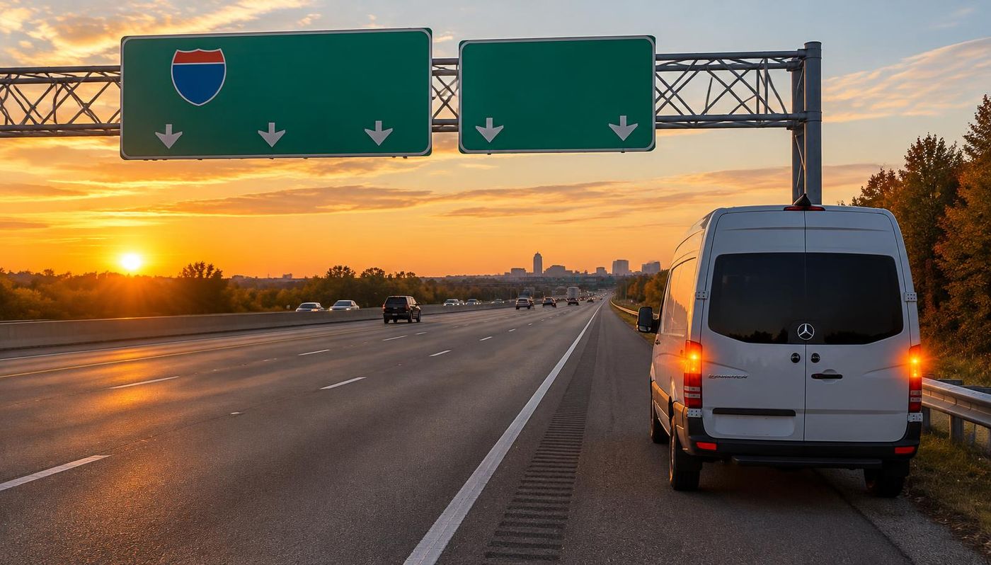
Roadside assistance on NY-27 Sunrise Highway
When something goes wrong on NY-27 Sunrise Highway, you need a plan, not a search engine. MVP Mobile Tire Shop and Roadside Assistance covers NY-27 Sunrise Highway across the Long Island service area with mobile tire service and roadside assistance, day and night, and our dispatchers know how to find you by exit, mile marker or map pin.
From the Queens line at Valley Stream, Sunrise Highway runs east through Nassau's South Shore communities and into western Suffolk. It becomes a freeway in the North Lindenhurst and West Babylon area east of NY-110, continues past Bay Shore, Islip, Patchogue and Shirley, then crosses the Shinnecock Canal toward Southampton. NY-27 continues beyond the Sunrise Highway name as local roads and Montauk Highway through the South Fork to Montauk Point State Park.
Our technicians are dispatched from inside the Long Island service area, not from a national call center, so they already know the exits, ramps and frontage roads around NY-27 Sunrise Highway. That local knowledge is what turns a vague location into a fast arrival.
Where NY-27 Sunrise Highway runs and what it connects
Connections include the Meadowbrook and Wantagh state parkways, NY-135, NY-110, NY-231, Robert Moses Causeway, Heckscher State Parkway, Nicolls Road, William Floyd Parkway and NY-24. The LIRR Babylon Branch parallels much of the Nassau corridor, while the Montauk Branch follows the South Shore and South Fork more broadly, not continuously beside the highway.
Sunrise changes from a signalized commercial arterial in Nassau and western Suffolk to a controlled access freeway and then to roads with intersections on the South Fork. Shopping traffic, commuter travel and summer visitor trips overlap. The Oakdale Merge and the transition toward Southampton are established constraints, but delay varies with conditions.
Because NY-27 Sunrise Highway ties so many neighborhoods together, we cover the surrounding communities as well, including Hempstead, Commack, Shirley, North Bay Shore, Bellmore, Ridge, Stony Brook University, Wading River, South Valley Stream, Searingtown. If you broke down on a ramp, a frontage road or a nearby surface street, the same dispatch line handles it.
Sunrise Highway is one part of the longer NY-27 route
NY-27 extends farther west than the Long Island portion commonly called Sunrise Highway. In Queens, the route approaches the Nassau boundary through the Conduit Avenue corridor before Sunrise continues into Valley Stream. The Queens line is therefore a useful starting point for this South Shore description, not the statewide western terminus of NY-27. Eastward, the Sunrise name also has limits: the route number continues through the South Fork after the freeway and the familiar Sunrise corridor end. A destination in Montauk is on the broader NY-27 route, not on an uninterrupted Sunrise freeway.
These name changes matter when asking for assistance. A caller saying only Route 27 could be on an urban street, a divided road with signals, a freeway shoulder or a two way road near Montauk. Begin with the nearest posted road name and community, then add the direction of travel. Distinguish NY-27 from NY-27A, which follows a separate South Shore alignment farther west. Montauk Highway also appears as a local road name outside the portion carrying NY-27. Read a route shield when one is visible rather than treating every Montauk Highway address as a location on the same state route.
Valley Stream through the Nassau South Shore villages
Across Nassau, Sunrise Highway connects the Valley Stream, Lynbrook and Rockville Centre corridor with Baldwin, Freeport, Merrick, Bellmore, Wantagh, Seaford and Massapequa. Some are incorporated villages and others are hamlets, so South Shore communities is a more precise collective description than calling every one a village. The road generally runs inland of Merrick Road and the tidal shoreline. Drivers encounter commercial properties, cross streets, turning movements and traffic signals rather than a continuous controlled access expressway. A short trip between adjoining communities can include several different intersection layouts and access points.
Shopping centers, dealerships and smaller businesses generate turns across this corridor. Pedestrians may be crossing between nearby neighborhoods, bus stops and stations, so a green signal is not a reason to ignore turning vehicles or people finishing a crossing. If a vehicle develops a problem, a lawful off road parking area may provide more separation from moving traffic than a curbside stop. That option depends on vehicle control, access restrictions and actual conditions. Never cut across opposing traffic, block a sidewalk or assume that a private entrance remains open simply because a business appears on a map.
The Babylon Branch and the parallel rail corridor
The Long Island Rail Road's Babylon Branch runs broadly alongside Sunrise Highway through much of Nassau's South Shore. The station sequence includes familiar communities such as Lynbrook, Rockville Centre, Baldwin, Freeport, Merrick, Bellmore, Wantagh, Seaford and Massapequa. The railway is not a service road, and the side of the highway nearest the tracks is not automatically a safe refuge. Station entrances and parking areas are reached from local streets. An elevated railway or station sign can nevertheless be a useful location reference when it can be identified without leaving a stopped vehicle.
Farther east, the relationship changes. The Montauk Branch continues through the South Shore toward Patchogue and the East End, but it does not remain immediately beside Sunrise Highway throughout Suffolk. NY-27 often lies north of the older village centers and their railroad stations. On the South Fork, rail and highway both serve the same general chain of communities without following identical alignments. A report that says near the tracks needs a cross street or station name as well. Never walk along a rail right of way to seek help or use a railway crossing as a place to stop.
Major Nassau connections and the NY-110 transition area
Sunrise meets the Meadowbrook State Parkway in the Freeport area, the Wantagh State Parkway farther east and NY-135 near Seaford. Those connections link the South Shore arterial with north and south routes, including approaches toward Jones Beach. Passenger vehicle restrictions apply on the parkways even though Sunrise itself carries commercial vehicles. A driver in a truck or towing a trailer must not assume that every signed connection is a usable alternate route. NY-135 is an expressway, while the similarly situated parkway connections have different vehicle rules and bridge conditions.
At the Nassau and Suffolk transition, Sunrise continues through the Amityville area and crosses NY-110 at a signalized intersection. It does not become a freeway at the county line or precisely at NY-110. Controlled access begins farther east around North Lindenhurst and West Babylon, where the road takes on mainline ramps and parallel service roads. The broad phrase near Amityville is useful for regional orientation but insufficient for locating a disabled vehicle. Report whether the location has traffic signals, exit ramps or a separate service road, and give the nearest cross street instead of guessing at an exit number.
The Suffolk freeway through Babylon and Islip
Through the Babylon and Islip portion of Suffolk, Sunrise functions as an important east and west freeway. NY-231 connects near North Babylon, Robert Moses Causeway provides a southbound beach approach at West Islip, and the Heckscher State Parkway crosses in the East Islip and Islip Terrace area. Bay Shore and Islip village centers lie to the south of much of this alignment. A destination advertised with a village name can therefore require a connecting road after the highway exit. The freeway is not a route through each older downtown shopping street.
The Oakdale Merge is the established name for the constrained corridor around the Heckscher connection and Oakdale, where the road layout and service road continuity differ from neighboring sections. NYSDOT has studied this area as a specific planning corridor. Do not assume that a frontage road offers an uninterrupted bypass when the mainline is congested. On any parallel road, signals, business entrances and separate ramp access can change the route. Tell an operator whether barriers separate you from the mainline and whether your vehicle is beside through lanes or on the local access roadway.
Patchogue, Bellport and Shirley on the central Suffolk corridor
East of Oakdale and Sayville, Sunrise continues toward the Patchogue area. Connections with Nicolls Road and NY-112 link the freeway to communities north and south, including the older downtown and rail corridor nearer Great South Bay. Beyond Patchogue, the road serves the East Patchogue and Bellport area before continuing toward Shirley. The freeway alignment bypasses many village streets, so a highway sign for a community is not proof that a stopped vehicle is within the incorporated village boundary. Road name, direction and the nearest interchange are more useful than a broad mailing address.
William Floyd Parkway is a major north and south connection at Shirley, linking the Sunrise corridor with the Long Island Expressway to the north and the Mastic Beach and Smith Point approach to the south. Farther east, the landscape becomes less continuously built up as NY-27 heads toward the Moriches area and Eastport. Businesses are not present at every point along the mainline, and available services depend on the exit and local roads. Check fuel before a longer East End journey rather than assuming that a shop visible on a distant sign is directly accessible from the shoulder.
Pine Barrens, Hampton Bays and the Shinnecock Canal
From the eastern Brookhaven area toward Southampton Town, NY-27 crosses a less densely developed landscape that includes Pine Barrens woodland. Westhampton area connections and the roads around Hampton Bays lead to communities south of the freeway and to other routes across the East End. This inland route does not follow the oceanfront beach continuously. A map may show a destination close to the highway while wetlands, woodland, railway property or limited public crossings require a longer legal approach. Use public interchanges rather than attempting access through an unmarked track or maintenance opening.
At Hampton Bays, the NY-24 connection is a major orientation point before the Shinnecock Canal crossing. NY-27 crosses the canal on the elevated Shinnecock Canal highway bridge, commonly called the Sunrise Highway bridge. This is distinct from the separate local road and railroad crossings. A breakdown report should identify which bridge carries the vehicle rather than simply saying canal bridge. Wind and precipitation can make an exposed crossing uncomfortable, and a bridge shoulder is not a preferred repair location. Continue beyond it only if the vehicle remains safely controllable; do not force a damaged vehicle onward merely to reach a more familiar landmark.
Southampton and the route onward to Montauk Point
East of the canal, the freeway gives way to the more constrained approach through Shinnecock Hills toward Southampton. Lane reductions and merging traffic help explain the familiar Shinnecock bottleneck. The route then follows surface roads around Southampton before continuing east as Montauk Highway. This is not a freeway extension through the Hamptons. Traffic signals, local intersections, turning vehicles and changing roadside development become central to the drive. Summer visitors and weekday employment traffic use many of the same roads, so the narrow corridor can be busy outside the familiar weekend arrival and departure periods.
NY-27 continues through the South Fork corridor serving Water Mill, Bridgehampton, Wainscott, East Hampton, Amagansett and Montauk. Beyond Montauk's developed center, the road continues east toward the lighthouse area and its terminus at Montauk Point State Park. The name Montauk Point State Parkway applies to the final approach, which should not be confused with the entire Sunrise Highway corridor. For a roadside call this far east, give the actual community and nearest signed landmark. A Southampton location and a Montauk Point location are not interchangeable descriptions merely because both lie along NY-27.
Four documented storms and what they do not prove
Sandy in October 2012 caused destructive South Shore coastal flooding and major disruption across Long Island. That history is relevant to communities reached from Sunrise, especially routes closer to bays and barrier beaches, but it does not establish that every mile of the highway was under water. The January 2016 blizzard brought heavy snow and severe travel conditions to Long Island. Snow can hide curb lines on the commercial arterial and reduce usable shoulder space on the freeway. During an active storm, follow official restrictions rather than relying on the road's normal speed or usual traffic pattern.
Isaias in August 2020 brought damaging winds, fallen trees and widespread power outages to Long Island. Outages can affect signalized portions of Sunrise and the local streets reached from freeway ramps. The August 2024 flooding involved extreme rainfall and destructive flooding in parts of Long Island, notably northern Suffolk; it was not uniform flooding of the entire South Shore route. These examples involve different hazards and different footprints. Check current alerts for the actual stretch being traveled, avoid flooded underpasses and never drive around a closure. Water depth and pavement damage cannot be judged reliably by watching another vehicle proceed.
Reporting the right roadway and choosing a safer stop
For assistance on Sunrise, specify eastbound or westbound, the nearest community, and whether the vehicle is on the arterial, freeway, ramp or service road. Add the last cross street or interchange and a map pin if available. In Nassau, a business name and street number can help distinguish adjacent entrances. In Suffolk, describe the nearest guide sign without walking toward it. On the South Fork, use Montauk Highway or the locally posted name when that is what the sign says. NY-27 itself is untolled, but parking and destinations beyond the road have their own rules.
If a tire fails, maintain steering control and avoid a sudden stop in a moving lane. Use a safely reachable refuge, activate hazard lights and assess the traffic exposure before opening a door. Do not try to cross the median or drive from the freeway onto a service road over grass. Remain belted when staying inside is the safer option, and contact 911 for injury, fire, an obstructed lane or immediate danger. A roadside tire change requires stable ground and adequate separation from traffic; a narrow shoulder does not become a safe work area simply because the vehicle fits within it.
The most important tip if you stop on NY-27 Sunrise Highway
On the signalized portion, use a lawful driveway or side street only if safely reachable and the vehicle remains controllable. On the freeway, identify whether you are on the mainline, a ramp or a service road. A service road is not reached by driving across grass or a gore. If you cannot leave a travel lane or face immediate danger, call 911.
In every case, turn on your hazard lights first. If you can reach the shoulder or an exit, steer there gradually instead of braking hard. Once stopped, keep your seatbelt on and stay in the vehicle when traffic is close. Never stand between the vehicle and moving traffic, and never try to change a tire on the traffic side of the car. If anyone is hurt, or the vehicle is blocking a travel lane, call 911 first, then call us.
When you reach dispatch, share four details: your direction of travel, the last exit or mile marker you passed, the vehicle's year, make, model and color, and what happened. A map pin from your phone is even better. That information lets us send the closest technician with the right equipment on the first trip.
Weather and road conditions on NY-27 Sunrise Highway
New York winters mean snow, ice and road salt, and the potholes that follow are a leading cause of bent rims and sidewall bubbles.
Highway speed builds heat in a tire faster than city driving does. An underinflated tire flexes more, runs hotter and is far more likely to fail at highway speed. Checking cold tire pressure once a month against the placard on the driver door jamb is the simplest way to avoid a blowout on NY-27 Sunrise Highway.
Road debris is the other common cause of highway flats: screws, metal from blown truck tires, and pieces of construction material. If a tire is losing air slowly, a plug or patch may still be possible, but driving on a flat ruins the sidewall. Stop early and call, and the repair is usually cheaper.
What we fix on the NY-27 Sunrise Highway shoulder
Our mobile service vehicles carry what is needed to finish most highway calls in one visit. That includes flat tire repair, roadside assistance, mobile tire repair, jump start service, mobile tire replacement, emergency roadside assistance, mobile tire shop, car lockout service and more.
For tire jobs, we plug or patch punctures in the tread when the repair is safe, mount your spare and torque the lug nuts correctly, or replace the tire with a new or quality used tire in your size. A damaged sidewall, a cut larger than a repairable puncture, or a tire that was driven flat needs replacement, and we will tell you honestly which one you have.
For other problems, we jump start dead batteries and test the charging system, replace batteries on site, deliver fuel when you run dry, open locked vehicles without damage, and winch vehicles out when they slide off the pavement. If a vehicle cannot be fixed on the shoulder, we arrange a tow to your home or the shop you choose.
Semi truck and commercial tire service on NY-27 Sunrise Highway
NY-27 Sunrise Highway carries delivery vans, box trucks and tractor trailers every hour of the day. MVP provides steer, drive and trailer tire service on the shoulder, so owner operators and fleet drivers do not lose a full day waiting for a shop.
Commercial calls go faster when the driver shares the unit number, the position of the failed tire, the tire size printed on the sidewall, and whether the load is hazardous or time sensitive. Fleet managers can set up an account for priority dispatch and consolidated billing.
Other highways we cover near NY-27 Sunrise Highway
Most drivers who use NY-27 Sunrise Highway also use I-495 Long Island Expressway, Southern State Parkway. MVP covers all of them, and we answer calls on every connecting ramp and frontage road in the Long Island service area.
If you are not sure exactly which road you are on, tell dispatch the last sign you saw, a nearby business or simply share your location. Our team will work out the rest and give you an honest arrival estimate before a technician heads your way.
How much highway roadside help costs
Price depends on what is wrong, the vehicle, the tire size if a tire is needed, the time of day and where on NY-27 Sunrise Highway you are. A spare installation on a sedan costs less than a new commercial tire at 2 a.m., and we explain the difference before you agree.
You get a firm quote by phone or text before dispatch. The number you approve is the number you pay. If the job turns out simpler than expected, you pay less, and if we cannot fix it, you do not pay for parts you did not receive.
NY-27 Sunrise Highway through the Long Island service area
In the Long Island service area, NY-27 Sunrise Highway is one of 3 major roads our technicians cover every day, alongside I-495 Long Island Expressway, Southern State Parkway. Drivers from Hempstead, Brookhaven, Islip, Oyster Bay, North Hempstead, Babylon and 174 more communities use it to reach work, school, airports and shopping.
When you call about a breakdown on NY-27 Sunrise Highway near Hempstead, dispatch routes the closest available technician in the Long Island area. If you would rather move off the highway first, we can meet you at the nearest safe parking lot, gas station or side street instead.
Commuting on NY-27 Sunrise Highway? Prevent the next roadside call
Most highway tire failures start as small problems: a slow leak, uneven wear or a tire that has aged out. If you drive NY-27 Sunrise Highway every day, MVP can rotate your tires, check tread depth and pressure, and replace worn tires at your home or office before they fail at highway speed.
Scheduled mobile service means no waiting room and no lost afternoon. We bring the tires, mount and balance them where you park, and you are ready for your next trip on NY-27 Sunrise Highway without a detour to a shop.
Electric vehicles on NY-27 Sunrise Highway
EVs are heavier than similar gas vehicles, so their tires work harder on long highway runs like NY-27 Sunrise Highway. Tesla, Rivian, Ford Mustang Mach-E and other EV owners can call MVP for EV-rated tire replacement and careful lifting at the correct jack points, so the battery pack is never at risk.
If your EV's range is running low on NY-27 Sunrise Highway, tell dispatch the charge level and your location. Our team can help you plan the safest next step and handle any tire or roadside issue on site.
Save the number before you need it
The middle of a breakdown on NY-27 Sunrise Highway is the wrong time to compare roadside companies. Save MVP's dispatch line in your phone now, and share it with family members who drive NY-27 Sunrise Highway too.
Calls and texts are answered around the clock, including nights, weekends and holidays, by a team that covers the Long Island service area every day. Call, text or book online, and we will get you back on the road.